
Visual Research Concept: St. Petersburg as a Cultural and Visual Landscape
Saint Petersburg represents a unique case of a city whose visual identity has been the result of deliberate construction since its founding, rather than organic growth. Established in 1703 as a «window to Europe,» the city was initially envisioned as a rationalist project, set against the backdrop of natural forces and preceding urban planning traditions. This artificial origin has defined a fundamental characteristic of the Petersburg visual landscape: a perpetual tension between the «processional» and the «non-processional,» the «stage» and the «backstage,» which Y. M. Lotman viewed as a key characteristic of urban semiotics.
The central problem of this study is that the visual image of a city is not singular for all of its inhabitants. A psychosemiotic analysis of autobiographical narratives from St. Petersburg residents reveals significant differences between the perception of native inhabitants and newcomers: for the former, the image of the city is constructed around personal routes and specific locations, while for the latter, it centers on «postcard» landmarks. This differentiation points to a fragmented visual experience that does not negate a shared identity, but rather makes it complex and multi-layered. The historical core, which constitutes only about 5% of the urban territory, forms a system of sign-symbols that provide stable understandings of historical space; however, outside of this core, the city’s visual logic changes considerably.
Key research question
A visual study of the city asks not what is seen, but how what is visible generates meaning and distributes values among different groups of citizens. This is particularly significant for St. Petersburg: the city was founded as a consciously constructed visual project—its panoramas, its «skyline, ” and its system of dominants were the result of urban planning design, not organic growth. Today, this design conflicts with the everyday experience of its residents, whose routes and personal maps do not align with the official visual canon.
Isaakiev Cathedral by O. Monferrand, 1818–1858
How do visual dominants and territorial boundaries shape the identity of a place in St. Petersburg, and to what extent do residents of different districts share a common visual image of the city?
Hypothesis
The visual image of St. Petersburg is fragmented along lines of administrative and informal boundaries; the historical center functions as a symbolic resource to which various groups appeal, yet it does not define their everyday visual experience.
Topics
1. St. Petersburg as Name and Space
2. Visual Dominants and Boundaries
3. Historical Layers: Imperial, Soviet, Post-Soviet
4. Semiotics of the Everyday
5. Place Identity: Locals vs. Migrants in City Narratives
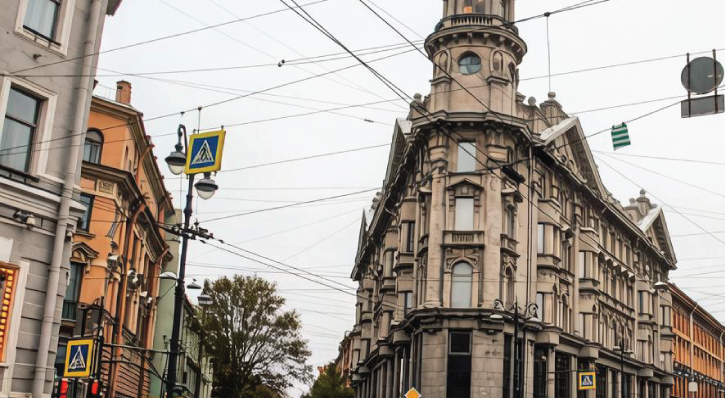
D. Ya. Ritz-a-Porta Income House (also known as the A. F. Paulucci House)
Selection Principle
The material was selected based on a combination of theoretical works on city semiotics (Lotman, Novikova/Markelova) and empirical studies of Petersburg daily life (microtoponymy, resident narratives, spatial analysis). Priority was given to sources that treat visuality not as mere illustration, but as an analytical category.
Geopolitical Image and the Semiotic Triad
Saint Petersburg possesses a unique semiotic biography, documented in its changing names: Peterburg—Petrograd—Leningrad—Saint Petersburg. Novikova and Markelova view this sequence as a «scale of cultural variability of space, ” where each name activates its own set of connotations and visual associations [1]. The geo-poetic image of the city is formed at the intersection of physical geography and the „geography of the soul, ” creating a multilayered semantic complex in which imperial splendor coexists with the tragic myth of the „city on bones“ [1].
Lotman, analyzing St. Petersburg’s symbolism, highlighted the distinct role of the city’s geographical location: its placement on the edge of the empire, at the boundary of water and land, creates a semiotic tension between the «self» and the «other, ” the center and the periphery [10]. This tension is visually anchored in the architectural dominance of the Admiralty, whose spire is visible from many districts and functions as a universal landmark, unifying the scattered parts of the city into a single whole.
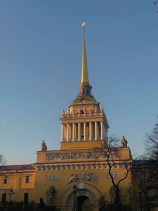
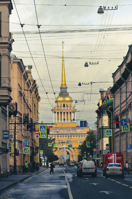
Admiralty Building, St. Petersburg Zakharov A. D., Korobov I. K. Admiralty. 1732–1738; 1806–1823.
Visual Dominants and Territorial Boundaries
St. Petersburg’s spatial structure is organized around several key axes, the primary one being the Neva River. Researchers who study the informal map of the city note that the city’s central core is localized at the intersection of Nevsky Prospekt, Dumskaya Street, and Mikhailovskaya Street, and the «Golden Triangle”—the area bordered by the Neva, Fontanka, and Gorokhovaya—functions as a zone visually and economically distinct from the rest of the city [8]. This boundary is not administrative, but it is palpable in the visual experience: the density of historic architecture, the quality of lighting, and the presence of pedestrian zones change dramatically upon crossing these invisible lines.
«The Golden Triangle» between the Neva, Fontanka, and Gorokhova streets
The Proletarian Belt—the periphery of the Petrograd Side and Vasilievsky Island outside the historical center—forms a contrasting visual landscape: industrial buildings, less dense housing, and a different street rhythm [8]. Boundaries here are marked not only by architecture but also by infrastructure: the Obvodny Canal is traditionally perceived as a symbolic line separating the «parade» city from the «working» city.
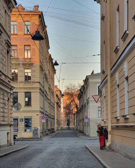
Vasilyevsky Island Streets
The third layer of the visual boundary in St. Petersburg is connected to the semiotics of the urban skyline. The sparse vertical dominants—the spires of the Peter and Paul Fortress and the Admiralty, and the domes of churches—rose above the general building line, not by disrupting it, but by accentuating and shaping an «ideal celestial line.» This line functioned as a visual code of belonging to a «ceremonial» city: proximity to the historical core indicated the density and height of the construction, and the clarity of the hierarchy of dominants. The violation of height regulations on the periphery—the appearance of late Soviet and post-Soviet high-rise buildings outside the center—visually cemented the boundary between the «museum city» and the «dormitory city.» Thus, the territorial boundaries are marked not only by the Obvodny Canal or construction density, but also by the right to verticality: the center maintains a monopoly on visual dominants, while the periphery settles for background development, and this inequality of visual resources reproduces the cultural hierarchy of the urban space.
View of the Admiralty and Peter and Paul Fortress
Historical Layers as a Visual Palimpsest
St. Petersburg’s identity is shaped by the overlay of historical epochs, each leaving its visual imprint. The Imperial layer is represented by regular planning, ensembles by Rossi and Rastrelli, and ordered architecture, which researchers note functions as a «complete text» of Palladianism, where every element possesses symbolic meaning [13]. The Soviet layer manifested in Constructivist housing complexes, industrial dominants, and renaming initiatives that altered the semiotics of urban toponyms.